Posts

Showing posts with the label website

MyMaps to Spreadsheet, KML to CSV and back

Image
I'm sharing a couple Python scripts that I used to update my Google MyMaps map for a website that I manage. Know your data On the  website I manage for the Friends of Silverbrook Cemetery, I created a Map of Sections page with an iframe of a Google MyMaps page. Each of these colored sections is a map layer of polygons. The major sections are Old Grounds, City Addition, Bond Addition, New Addition, Garden of Memory and Garden of Eternal Peace.   Each of those polygons was hand drawn in MyMaps. In addition to the polygon, I have pins in a separate layer called "Points of Interest".   Those pins have a slightly different data structure than the polygons.   For now I'm just going to focus on the polygons. As an example, I'm going to take that large yellow triangle in section New-63 and distort it.   First, I need to export the New layer of the map to a KML file.   I select "Export to KML/KMZ". I just need the KML file.  A KMZ is a zip archive...
HTML MAP tag, lessons learned

Image
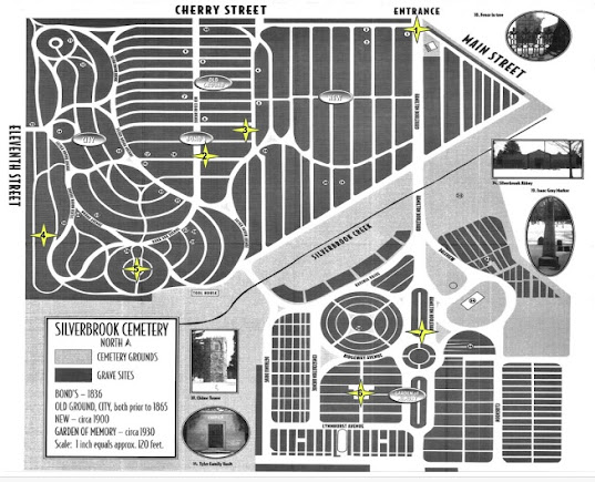
This year the Friends of Silverbrook Cemetery is hosting a virtual tour instead of the regular annual walking around tour for the cemetery.  The tour guide is Mollie Watson from the Niles History Center .  I recreated what Mollie did in Google Slides on the website.  This included copying images, cutting and pasting text, while trying to keep the flow of the presentation. One slide that I found challenging was the hyperlinked map.  When you click on a star marker, you go to a page related to that part of the cemetery.  Here is the JPG file from the Virtual Tour Map page. The most important step I found was to size your image properly. The original image was 1112x906 pixels.  I uploaded the image into a Joomla media folder and used the JCE editor to resize the file until it looked good. The new size of the image was 653x529, which is about half. I opened the image in Paint.  I clicked the Resize option under Home->Image.  I selected pixels and...